GTA 6 Printable Map
A4 and A3 landscape sheets of Leonida with the six regions and the atlas legend.
Quick answer
Is there a printable GTA 6 map?
Yes. This page prints the Leonida atlas as a single A3 or A4 landscape sheet: the six featured regions, the atlas legend and the date of the data. Use your browser’s Print command; nothing needs to be installed.
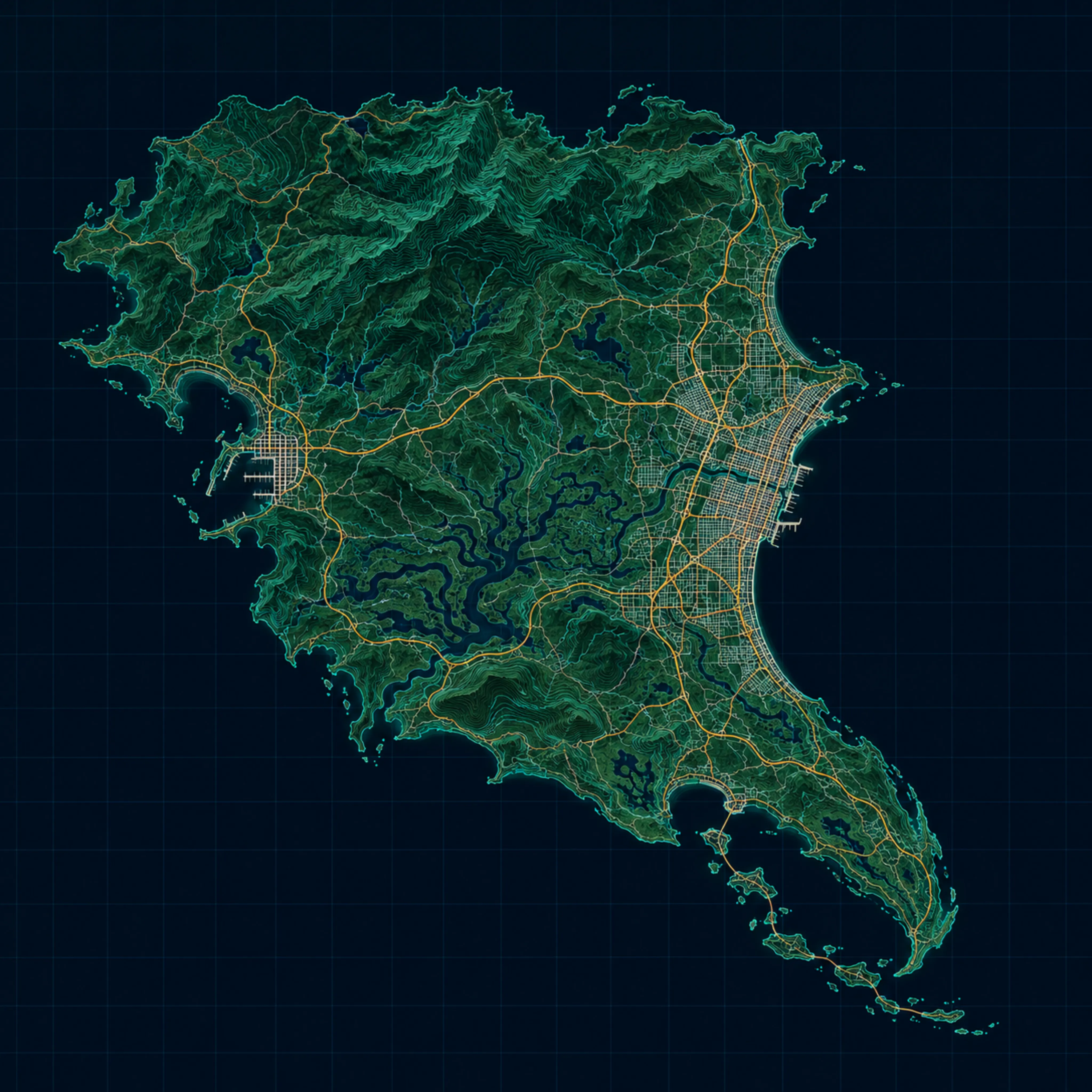
Schematic map, not a traced game map. Positions are approximate. Use the interactive map for the pin list.
What is on the sheet
The sheet is built from the same atlas as the interactive map. It covers the six regions Rockstar has featured and 798 pins: landmarks, businesses and activities. The legend names the regions with their pin counts so you can decide where to start before you unfold a paper copy.
| Region | Pins on the sheet | What it is known for |
|---|---|---|
| Vice City | 499 | Coastal city, beaches, hotels, the airport and the stadium |
| Port Gellhorn | 157 | Port town, industrial edge, the raceway and Watson Bay |
| Leonida Keys | 60 | Island chain, marinas, the oceanarium and Key Lento |
| Mount Kalaga | 32 | National park, speedway, prison and the mountain ridge |
| Ambrosia | 30 | Industrial town and the raceway park |
| Grassrivers | 20 | Wetlands, the visitor centre and the mud club |
Only named places are called out on the printed legend. Every pin, including the smaller ones, is on the interactive map and in the region guides.
Print settings that work
| Setting | What to choose | Why |
|---|---|---|
| Paper | A3 landscape | Keeps the region names and the legend readable at arm’s length. |
| Alternative | A4 landscape | Fits a desk copy; the smallest labels need a closer look. |
| Scale | 100% or “fit to page” | The image is square, so a landscape page leaves side margins, not crop. |
| Colour | Colour | The map uses colour to separate water, roads and land; greyscale loses contrast. |
| Margins | Default or 8 mm | A wide printer margin can push the legend onto a second page. |
If your browser adds a header and footer, turn off “Headers and footers” in the print dialog. The sheet already carries its own title and date.
Printable map, official map and interactive map
Three different things share the name “GTA 6 map”. The official map is Rockstar’s published material. This printable sheet is an independent schematic for planning. The interactive map is the working tool: filter by region, search a name, open a pin and tick it off.
The printable sheet does not claim to be a traced copy of the game map, and it does not carry in-game coordinates. Its job is to let you see the whole state on one page and mark a route with a pen. For the exact pin record, open the location page linked from the locations guide.
How to use the printed sheet with the atlas
- Print one sheet per region group. A3 for the wall, A4 for the bag.
- Pick a route. Use the region order: Vice City, the Keys, Grassrivers, Port Gellhorn, Ambrosia, Mount Kalaga.
- Mark found places. Tick the paper, then tick the same pin on the interactive map so the digital checklist stays current.
- Check the record. Before driving to a pin, open it and read the mapping record; positions are approximate.
- Re-print after a data update. The sheet carries the atlas date; the interactive map is always the current version.
What the sheet does not include
It does not include collectible totals, mission order, cheat codes or prices. Those pages change as launch-week checks come in, and a paper copy would be out of date before it left the printer. The sheet is deliberately limited to geography and the named places that are stable enough to print.
It also does not include your personal checklist. That stays on the map and, if you sign in with Google, on your account across devices.
Why a paper copy still helps
A second screen is useful until you are halfway through a region and the phone is the thing holding the map. A printed sheet stays open on the desk, takes a pencil mark, and does not dim when the game loads. It also makes the shape of Leonida obvious in a way a zoomed map does not: the Keys trail south, the Grassrivers cut across the middle, and Mount Kalaga sits away from the coast.
Use the paper for the route and the interactive map for the record. That split keeps the printed copy useful even after a data update, because the route does not change when a pin is re-checked.
FAQs
How do I print the GTA 6 map?
Open this page in Chrome, Safari or Edge and choose Print. Set the paper to A3 or A4, orientation to landscape, and scale to fit the page. The sheet is designed to print on one page; A3 keeps the region names readable.
Is there an official printable GTA 6 map?
Rockstar has published its own map material. This page is not a copy of it: it is an independent schematic built for route planning, with the six featured regions and the pins recorded in this atlas. Check Rockstar’s official channels for the official version.
Can I use this map to navigate in game?
It is a planning sheet, not a surveyed map. Region positions and pin coordinates are approximate. Use the interactive map for the pin list and open a pin to see its record before you drive to it.
Why are there 798 pins but only 94 named places in the sitemap?
Every pin is on the interactive map. Ninety-four named places have their own indexable guide page; the rest are reachable from the region pages and the map but are kept out of the search index until they have enough verified detail.
What paper size works best?
A3 landscape is the best balance: the six region labels and the legend stay readable. A4 landscape works for a desk copy; print at 100% scale and do not select “fit to printable area” if your printer adds wide margins.
Does the print include my checklist?
No. The sheet is a clean map, not your personal progress. Your found list stays on the interactive map and follows you across devices when you sign in with Google.